


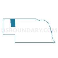
South Sheridan Precinct, Sheridan County, Nebraska
About
Outline

Summary
| Unique Area Identifier | 613944 |
| Name | South Sheridan Precinct |
| County | Sheridan County |
| State | Nebraska |
| Area (square miles) | 1,267.22 |
| Land Area (square miles) | 1,240.05 |
| Water Area (square miles) | 27.17 |
| % of Land Area | 97.86 |
| % of Water Area | 2.14 |
| Latitude of the Internal Point | 42.26297700 |
| Longtitude of the Internal Point | -102.37893700 |
Maps


Graphs
Select a template below for downloading or customizing gragh for South Sheridan Precinct, Sheridan County, Nebraska


Neighbors
Neighoring Voting District (by Name) Neighboring Voting District on the Map
- 11 Precinct, Box Butte County, NE
- Blue Creek Precinct, Garden County, NE
- East Gordon Precinct, Sheridan County, NE
- Gilchrist Precinct, Morrill County, NE
- Hay Springs Precinct, Sheridan County, NE
- Hyannis Precinct, Grant County, NE
- King Precinct, Cherry County, NE
- Lisco Precinct, Garden County, NE
- Lost Creek Precinct, Garden County, NE
- Merriman Precinct, Cherry County, NE
- Mirage Precinct, Sheridan County, NE
- Mother Lake Precinct, Cherry County, NE
- Russell Precinct, Cherry County, NE
- South Rushville Precinct, Sheridan County, NE
- West Gordon Precinct, Sheridan County, NE
Top 10 Neighboring County Subdivision (by Population) Neighboring County Subdivision on the Map
- Eleven precinct, Box Butte County, NE (9,840)
- Hay Springs precinct, Sheridan County, NE (951)
- Lost Creek precinct, Garden County, NE (750)
- Blue Creek precinct, Garden County, NE (553)
- South Sheridan precinct, Sheridan County, NE (546)
- Mirage precinct, Sheridan County, NE (298)
- Merriman precinct, Cherry County, NE (282)
- Lisco precinct, Garden County, NE (183)
- Ashby precinct, Grant County, NE (123)
- Mother Lake precinct, Cherry County, NE (77)
Top 10 Neighboring Unified School District (by Population) Neighboring Unified School District on the Map
- Alliance Public Schools, NE (9,813)
- Valentine Community Schools, NE (4,515)
- Gordon-Rushville Public Schools, NE (4,465)
- Garden County Schools, NE (2,097)
- Hemingford Public Schools, NE (1,866)
- Hay Springs Public Schools, NE (1,091)
- Hyannis Area Schools, NE (886)
Top 10 Neighboring State Legislative District Upper Chamber (by Population) Neighboring State Legislative District Upper Chamber on the Map
Top 10 Neighboring 111th Congressional District (by Population) Neighboring 111th Congressional District on the Map
Top 10 Neighboring Census Tract (by Population) Neighboring Census Tract on the Map
- Census Tract 9525, Morrill County, NE (5,042)
- Census Tract 9512, Box Butte County, NE (4,832)
- Census Tract 9513, Box Butte County, NE (4,217)
- Census Tract 9517, Sheridan County, NE (3,254)
- Census Tract 9511, Box Butte County, NE (2,259)
- Census Tract 9521, Garden County, NE (2,057)
- Census Tract 9559, Cherry County, NE (1,426)
- Census Tract 9563, Grant County, NE (614)
Top 10 Neighboring 5-Digit ZIP Code Tabulation Area (by Population) Neighboring 5-Digit ZIP Code Tabulation Area on the Map
- 69301, NE (10,125)
- 69343, NE (2,538)
- 69360, NE (1,361)
- 69347, NE (1,249)
- 69333, NE (239)
- 69351, NE (235)
- 69340, NE (121)
- 69335, NE (53)